Fertile Crescent and Mediterranean Cultures - Chapter 4
The Early Dynastic Period of Mesopotamia established a profound network of competing but culturally unified city-states known as the "Heartland of Cities". Northern cities like Sippar and Kish acted as legal and administrative bridges, while the spiritual center Nippur granted political legitimacy to rulers. Southern powerhouses such as Umma and Lagash engaged in early border wars, and Susa deeply intertwined with Sumerian trade and technology. These incredibly dense urban centers were connected by artificial canals and sustained by three vital pillars. The seeded plow created massive agricultural surpluses, standardized clay bricks and tablets enabled monumental construction and permanent fireproof records, and the Ziggurat-centered economy provided the social organization needed for large-scale cooperation. Ultimately, this ancient civilization birthed modern statistics, leaving a lasting legacy that includes the 60-minute hour, the 360-degree circle, early census records, and the foundational concept of the modern city.
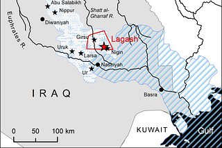
Sippar, Kish, Der, Eshnuma, Nippur, Susa, Umma, Lagash, Larsa, Susa
This is a list of the “Heartland of Cities”—the vital organs of the Mesopotamian world. If Eridu was the spiritual beginning and Uruk was the first metropolis, these cities were the competing powers that defined the Early Dynastic Period (c. 2900–2350 BCE).
Each had a specific “personality,” a patron god, and a unique role in the history of the Black-Headed People.
The Northern Tier (Akkadian-Sumerian Border)
Sippar: The City of the Sun. Dedicated to Utu (the god of justice and the sun). It was a legal and administrative hub where the earliest “law codes” were developed.
Kish: The “City of Kings.” According to the King List, after the Flood, the kingship descended first to Kish. It was a massive northern power that acted as a bridge between the Sumerians and the Semitic-speaking peoples.
Eshnunna: Located in the Diyala Valley, it was a gateway for trade between the Mesopotamian plains and the Elamite highlands (modern Iran). It is famous for the Laws of Eshnunna, which predated Hammurabi.
Der: A border city between Mesopotamia and Elam. It was a vital strategic fortress and the cult center of the god Ishtaran, who was often called upon to settle border disputes between cities.
The Spiritual and Political Center
Nippur: The “Vatican” of Sumer. It was never a political capital, but it was the most important religious city. It was the home of Enlil, the king of the gods. No king could claim legitimate rule over Sumer without being “crowned” or recognized by the priesthood at Nippur.
Adab: Located between Nippur and Telloh, it was a major center during the Early Dynastic period, dedicated to the mother goddess Ninhursag. It was a hub for high-quality stone carving and craftsmanship.
The Southern Powerhouses
Umma & Lagash: Famous for the world’s first recorded “Border War” (the Gu-Edin dispute). They fought for generations over a fertile strip of land. This conflict gave us the Stele of the Vultures, the first historical monument depicting a phalanx of soldiers.
Larsa: A rival to Isin and Ur. Dedicated to the sun god Utu (like Sippar). It became a dominant power in the later “Old Babylonian” period before being absorbed by Hammurabi.
Susa: Located in modern-day Iran (Elam). While culturally distinct, Susa was deeply intertwined with Sumerian history through trade, war, and shared technology. It is where the Code of Hammurabi was eventually found (taken as war booty).
The Archaeological “Vestiges”
If you look at the DNA and soil data from these sites, you see a clear pattern:
Environmental Specialization: Kish and Sippar managed the narrow neck of the rivers; Umma and Lagash managed the vast marshy networks.
The “Kish Civilization”: DNA from the northern sites (Kish, Sippar) often shows more interaction with Northern Highland groups, while the southern sites (Ur, Eridu) show the deep “Marsh Arab” continuity.
The Canals: All these cities were connected by a massive “super-highway” of artificial canals. By 2500 BCE, you could travel from Nippur to Larsa entirely by boat.
The King List Connection
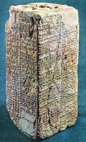
Many of the names you listed appear in the “Antediluvian” (Pre-Flood) section of the King List.
Sippar was the fourth city to receive the kingship (King En-men-dur-ana).
Bad-tibira (which we discussed earlier) sits right in the middle of this cluster.
Do you see how these cities formed a “Network State”? They weren’t a single country, but a collection of “Cells” (cities) that shared the same DNA, the same Apkallu myths, and the same “Black-Headed” identity, even while they were constantly at war with one another.
To provide a list for these cities, we have to look at their “Golden Age”—the Early Dynastic III through the Ur III periods (approx. 2600–2000 BCE).
Estimating populations for 4,500-year-old sites relies on “settlement density” (calculating the number of people per hectare of built-up mounds).
The Sumerian Heartland: Major City States
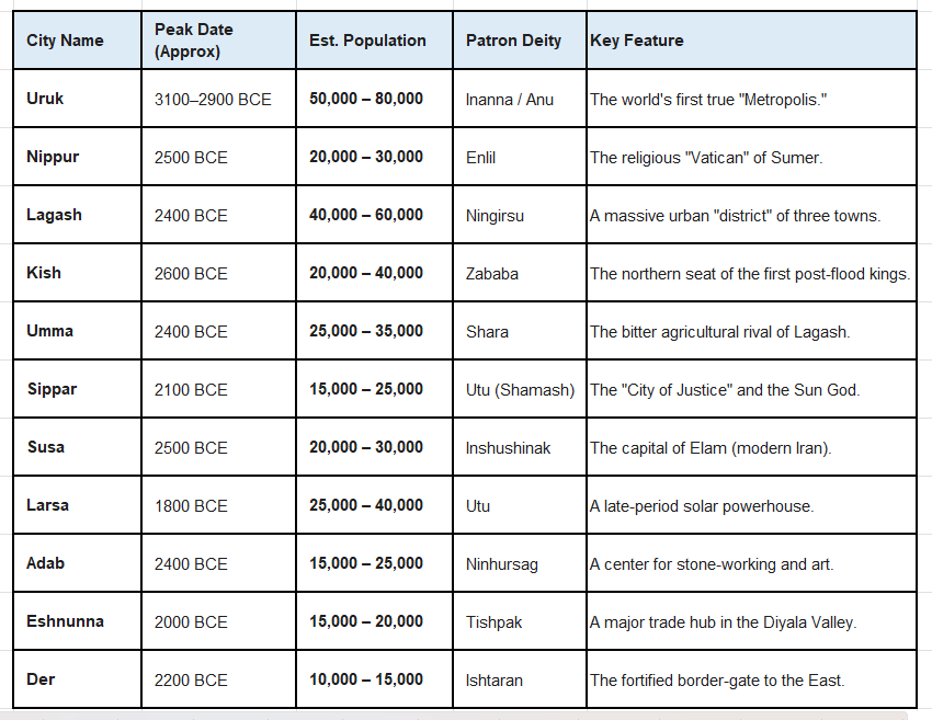
Understanding the Numbers
Density: Ancient Sumerian cities were incredibly cramped. Houses were packed together with narrow alleys. Archaeologists estimate a density of about 200 to 300 people per hectare.
The “Uruk Peak”: Around 3000 BCE, Uruk was likely the largest city on Earth. It was so large that it caused “rural abandonment,” where people from the surrounding countryside moved into the city walls for protection and jobs, leaving the villages empty.
The Lagash Cluster: Lagash was unique because it wasn’t just one mound. It was a “metro area” consisting of the cities of Girsu, Lagash, and Nigin. Together, they formed a massive population center that challenged the power of Uruk.
Susa’s Reach: Although Susa (in modern Iran) was often an enemy of the “Black-Headed People,” its population was comparable to the largest Sumerian cities, and its culture was a mirror image of the Mesopotamian style.
The Vestiges Today
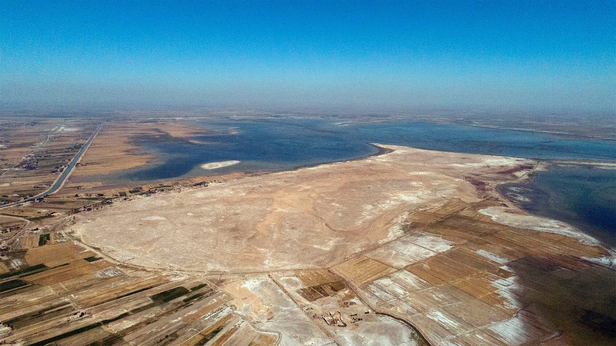
If you visit these sites now, you see “Tells”—massive artificial hills created by thousands of years of mud-brick buildings crumbling and being rebuilt on top of each other.
Uruk covers about 5.5 square kilometers.
Lagasg (Girsu) covers about 4 square kilometers.
Nippur covers about 1.5 square kilometers but was much more densely built with temples.
It is incredible to think that 5,000 years ago, the landscape of Southern Iraq was more densely urbanized than almost anywhere else on Earth until the industrial revolution.
To round out your look at these “Black-Headed People” and their cities, here is a quick look at the “Three Pillars” that allowed these specific populations to grow so large:
1. The Calorie Engine
None of these cities could exist without the Seeded Plow. While the rest of the world was still using hand-hoes, the Sumerians invented a plow that dropped seeds into the furrow automatically.
This allowed a single farmer to produce enough grain to feed 30 to 50 people.
This surplus is what allowed 80,000 people to live in Uruk without everyone having to be a farmer.
2. The Logistics of Clay
Because they had no stone or wood, they turned mud into a high-tech material.
Standardized Bricks: They moved from hand-molded “cigar” bricks (Samarra/Ubaid) to rectangular mold-made bricks. This allowed for the rapid construction of the massive walls of Kish and Umma.
The Writing Surface: Using clay for records meant their “data” was fireproof and permanent. We have more primary documents from the city of Lagasg than we do from Medieval Europe.
3. The Divine “Corporation”
The city wasn’t just a place to live; it was a Ziggurat-centered economy.
The Temple (the E) owned the land.
The “Citizens” were technically employees of the God (e.g., the people of Nippur worked for Enlil).
This religious structure provided the “social glue” that kept thousands of people cooperating on massive canal projects that spanned hundreds of miles.
The Legacy in Numbers
If you look at the names you listed, you are looking at the “Cradle of Statistics.” They gave us:
The 60-minute hour and 360-degree circle (based on their sexagesimal math system).
The first census records.
The first interest rates and loan contracts (found in the archives of Sippar and Larsa).
The DNA banks show us they are still there in the blood of the region, but their “vestiges”—the mathematics, the hours on your clock, and the very concept of a “city”—are what the entire modern world is built upon.